

Arnamuil [Arnamul]
Good walks are even better shared.
Overview
Arnamuil [Arnamul]
Overview
Arnamuil, standing tall at 636 meters, is a celebrated Marilyn in Northern Ireland's stunning landscape. This mountain offers a delightful mix of challenging terrain and breathtaking views, making it a favourite among hikers and outdoor enthusiasts alike.
Geology
The mountain comprises predominantly of basalt rock, remnants of ancient volcanic activity. Its geological features include rugged cliffs and exposed strata, a tale of the Earth's fiery past. Keep your eyes peeled for interesting rock formations that tell you that the earth has had quite the explosive history!
Routes
Summit from Glenariff Forest Park
This pleasantly moderate route starts in the beautiful Glenariff Forest Park. Here, you’ll meander through lush woodlands, occasionally looking up to remind yourself how high you’ll soon be heading. The path offers variety, taking you from forest paths to open hills, perfect for those who appreciate a bit of a workout with their nature.
- Distance: 7.5 km
- Estimated Time: 3.5 hours
Summit Features
Upon reaching the summit, hikers are greeted with a proud stone cairn, signalling the hard-fought battle against gravity that you've just conquered. The lookout point also allows for some seriously Instagram-worthy shots of the breathtaking landscapes surrounding you.
Terrain Type
Expect a delightful mix of grassy slopes interspersed with rugged rocky outcrops—and a few boggy patches that remind you you’re still in the wild. Sensible footwear is your best friend here so you don’t end up with muddy socks!
Views
The vistas from atop Arnamuil are simply spectacular! Hikers are treated to sweeping views of the Antrim coast and the Mourne Mountains. And if you’re lucky enough to hike on a clear day, you might just spot the Isle of Man in the distance. The best times for these views are late spring and autumn when the colours of the landscape pop!
Hazards
As with any great trek, there are potential hazards. Loose rocks can be mischievous, ready to trip up the unwary hiker, and when the rain pours down, the paths can become quite slippery. Sudden changes in weather can also catch you off guard, so be prepared!
Nearby Summits
If you've still got the legs left, nearby summits such as Slieveanorra (705 m) and Cairnshill (498 m) are worth a look. After all, why stop climbing when there are more peaks to conquer?
Access
Nearest Parking
Glenariff Forest Park offers ample round-the-clock parking facilities, perfect for your steed. Just make sure to arrive early during peak season, as spaces fill up faster than a tea kettle!
Public Transport
Public buses connect from Ballymena to local towns, though be prepared for a bit of a hike from the bus stop to reach the trailhead.
Nearest Town
The charming town of Ballymena is the closest, only about 12 miles away, providing a lovely pit stop before or after your adventure.
Facilities
The Glenariff Forest Park features essential amenities, with toilet facilities and a café where you can grab a lovely bite to eat after an exhilarating day in the hills.
History
Name Meaning
The name 'Arnamuil' loosely translates to 'the height of the great dark', which seems fitting for a place that has its fair share of looming cliffs and shadowy valleys.
Significance
This mountain is part of the culturally rich Glens of Antrim, an area imbued with history and significance, showcasing Northern Irish beauty at its best.
Get out there, and embrace all that Arnamuil has to offer—just remember, no mountain is too high when a good cuppa awaits at the summit (or the café)!
Explore routes near Arnamuil [Arnamul]
Public walks starting within 80 km of this hill. Nearby does not mean a route reaches the summit; check its map and access before setting out.
Route planning notes
These notes describe possible approaches, not verified navigable routes or permission to cross land. Check current paths, local access rules and conditions before setting out.
Summit from Glenariff Forest Park
A popular route starting from Glenariff, winding through forested areas before ascending to the summit. This route offers a good mix of woodland and open hill walking.
Make a day of it, together
Find someone to share the walk with, or organise a day out along a route you like.
Photo Gallery
View all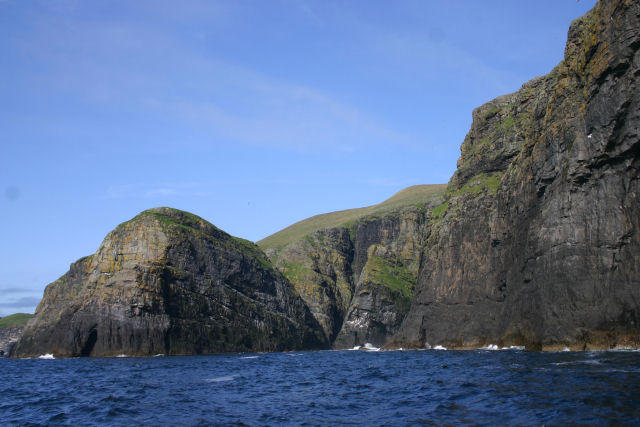 Photo could not load
NL5482 : West coast of Mingulay
Bob Jones
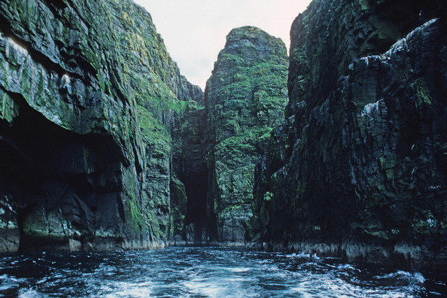 Photo could not load
NL5482 : Passage beside Arnamuil and Mingulay
Julian Paren
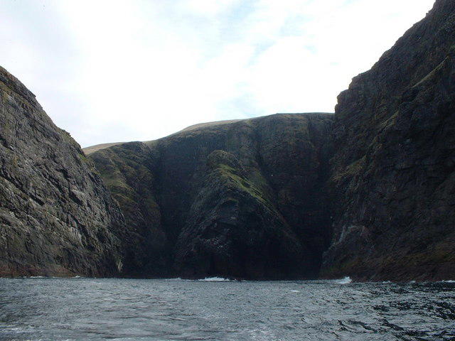 Photo could not load
NL5482 : After passing under the natural arch
Russel Wills
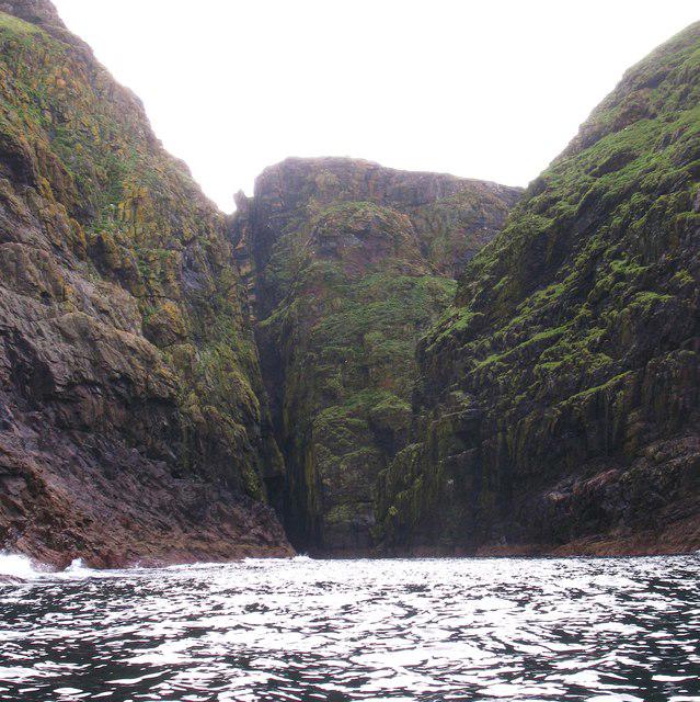 Photo could not load
NL5482 : The channel between Mingulay and Arnamul
Gordon Hatton
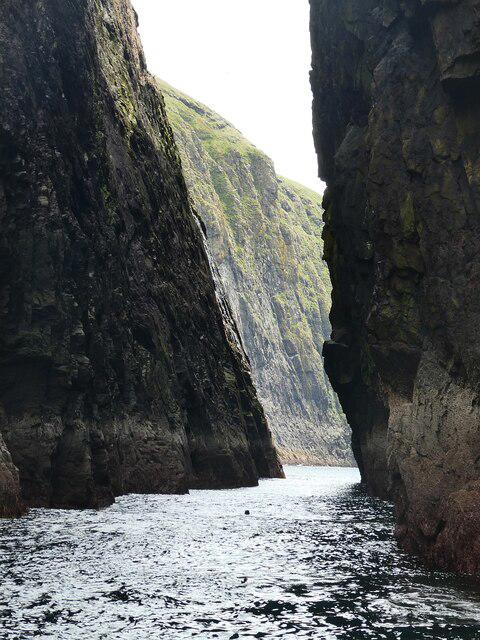 Photo could not load
NL5482 : Mingulay - The narrow gap separating Arnamul from Mingulay
Rob Farrow
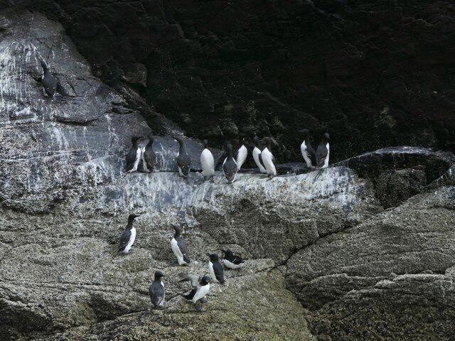 Photo could not load
NL5482 : Guillemots, Gunamuil
Richard Webb
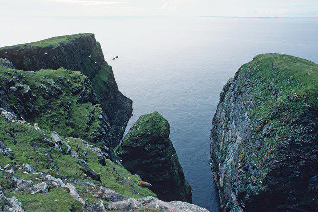 Photo could not load
NL5482 : Passage between Arnamuil and Gunamuil
Julian Paren
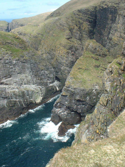 Photo could not load
NL5482 : Convoluted coastline
Russel Wills
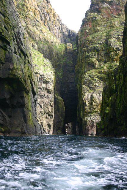 Photo could not load
NL5482 : Natural arch, Mingulay
Bob Jones
Hill facts and local notes
Classifications
Elevation
121m
397 ft
Prominence
121m
Coordinates
56.8055, -7.6622
NL545825
OS Map
31
Explorer: 452S
At the Summit
The summit is marked by a prominent stone cairn, providing a sense of accomplishment for those who reach it. There's also a stunning lookout point for panoramic views.
Terrain & Geology
Arnamuil consists predominantly of basalt rock, formed from ancient volcanic activity. Its geological features include rugged cliffs and exposed strata that tell the story of the region's explosive past.
Views & Scenery
From the summit, hikers can enjoy views of the Antrim coast, the Mourne Mountains, and on clear days, the Isle of Man might even come into view.
History & Heritage
Name Origin
The name 'Arnamuil' is believed to mean 'the height of the great dark', which suitably reflects its majestic stature and the shadows cast by its cliffs.
Historical Significance
The area around Arnamuil holds cultural significance, being part of the rich heritage of the Glens of Antrim.
Getting There & Facilities
Check current local access restrictions, parking rules and transport timetables before travelling. These notes do not confirm public access to the summit.
Parking
Glenariff Forest Park offers ample parking facilities, though spaces can fill up during peak tourist season.
Public Transport
Public buses run from Ballymena to the nearby towns, with a bit of a walk to reach the trailhead.
Nearby Facilities
Glenariff Forest Park has toilet facilities and a café, especially handy for a post-hike treat.
Safety Information
Known Hazards
- Care should be taken with loose rocks on the ascent. The terrain can be slippery when wet, and sudden weather changes can occur.
General Safety Tips
- Check weather conditions before setting out
- Carry appropriate clothing and equipment
- Let someone know your planned route
- Take a map, compass, and GPS device
- Carry emergency supplies: food, water, first aid kit, torch
Hills
Some common questions about the hills answered
Are there group walks up Arnamuil [Arnamul]?
Many walkers use Walkmates to join or organise walks with others. You can check for group walks around Arnamuil [Arnamul] through the maps
Are there other walkers around Arnamuil [Arnamul]?
Activity varies by location and time, but Walkmates lets you see whether others have shared walks or shown interest in this area. Find other people through the walking friends search walking friends for Arnamuil [Arnamul] search or of course create your own walk for Arnamuil [Arnamul]
Can I organise a walk to Arnamuil [Arnamul]?
Yes. If there aren’t any walks listed already, you can create a walk and make it available for others to join.
If you're signed up to Walkmates, you can create a walk to Arnamuil [Arnamul].
How do I find a walk up this hill?
There are often multiple ways to walk this hill, depending on experience and route preference. Walkmates helps you explore walks and routes that others have shared.
Can I suggest a new route up Arnamuil [Arnamul]?
Yes. You can suggest or create routes to share with others. Walkmates focuses on the social side of walking, so routes are used to help people organise walks and explore areas together, rather than as detailed navigation tools or route libraries.
Other uses really appreciate knowledgeable walkers sharing their routes. Share your favourite route to Arnamuil [Arnamul] here
The is an error or something incorrect about this hill. How do I let you know?
We always strive to keep the information on Walkmates as accurate as possible. If you find an error, please let us know through the contact form and we'll aim to correct it as quickly as possible
Community Discussion
Comments
Location
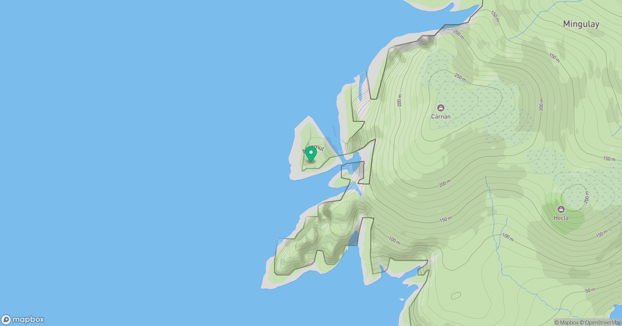
Grid reference: NL545825
View on OpenStreetMapOpens a map in a new tab, centred on the hill.
Hills within 30 km
Straight-line distance, not a walking route or confirmation of access.
No comments yet. Be the first.